
Old Ordnance Survey Maps of Walsall
These detailed maps normally cover an area of about one and a half miles by one mile. Each map includes an introduction.
They are available through our On-line Mapshop.
These are the maps in today's Walsall MBC area. They are taken from the OS 25" maps and reduced to a scale of approximately
15 inches to the mile. They are extremely detailed, showing individual houses, details such as railway tracks, pathways,
pubs, factories and even minutiae such as fountains and signal posts. Each covers an area a mile by a mile and a half and includes an introduction.
 These are the maps for the Walsall area:
57.08 Brownhills & Ogley Hay 1901 published 2002; introduction by Cath Yates
57.11 Pelsall (North) 1883 publ 1995; intro by A Tomkinson.
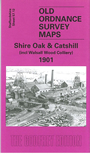
57.12 Shire Oak & Catshill (incl Walsall Wood Colliery) 1901 publ 2005; intro by Cath Yates
57.14 Bloxwich 1902 publ 1993; intro by Stuart Williams
57.15 Pelsall (South) 1901 publ 2008; into by Malcolm Nixon
57.16 Walsall Wood 1901 publ 2008; into by Malcolm Nixon
62.08a Willenhall (NW) & Wednesfield 1901 publ 1997; intro by Horace Davis
62.08b Willenhall (NW) & Wednesfield 1913 publ 2021; intro by Barrie Trinder
62.12a Willenhall (SW) 1901 publ 1996; intro by Horace Davis
62.12b Willenhall (SW) 1913 publ 2021; intro by Barrie Trinder
63.02 Leamore & South Bloxwich 1900 publ 2002; intro by Stuart Williams
63.03 Rushall 1913 publ 2013; into by Malcolm Nixon
63.05a Willenhall (NE) 1885 publ 1991; intro by Cath Yates
63.05b Willenhall (NE) 1913 publ 2013; intro by Malcolm Nixon
63.06a Walsall (NW) 1902 publ 1992; intro by Cath Yates
63.06b Walsall (NW) 1913 publ 2021; intro by Barrie Trinder
63.07 Walsall (NE) 1913 publ 1992; intro by Ann French
63.09a Willenhall SE & Darlaston Green 1885 publ 1990; intro by Cath Yates
63.09b Willenhall SE & Darlaston Green 1901 publ 2009; intro by Malcolm Nixon
63.09c Willenhall SE & Darlaston Green 1913 publ 2021; intro by Barrie Trinder
63.10a Walsall (SW) & Pleck 1901 publ 1993; intro by Cath Yates
63.10b Walsall (SW) 1913 publ 2021; intro by Barrie Trinder
63.11a Walsall (SE) 1901 publ 1993; intro by Ann French
63.11b Walsall (SE) 1903 publ 2021; intro by Barrie Trinder
63.13a Darlaston & King's Hill 1901 publ 1988; intro by John Maddison
63.13b Darlaston 1913 publ 2018; intro by Barrie Trinder
63.14a Bescot 1901 publ 1986; intro by John Maddison.
63.14b Bescot 1913 publ 2017; intro by Barrie Trinder
63.15 The Delves 1912 publ 2008; into by Malcolm Nixon
68.04 Great Barr 1901 publ 2002; intro by Alan Godfrey
68.08 Hamstead 1913 publ 2012; intro by Michael Jee
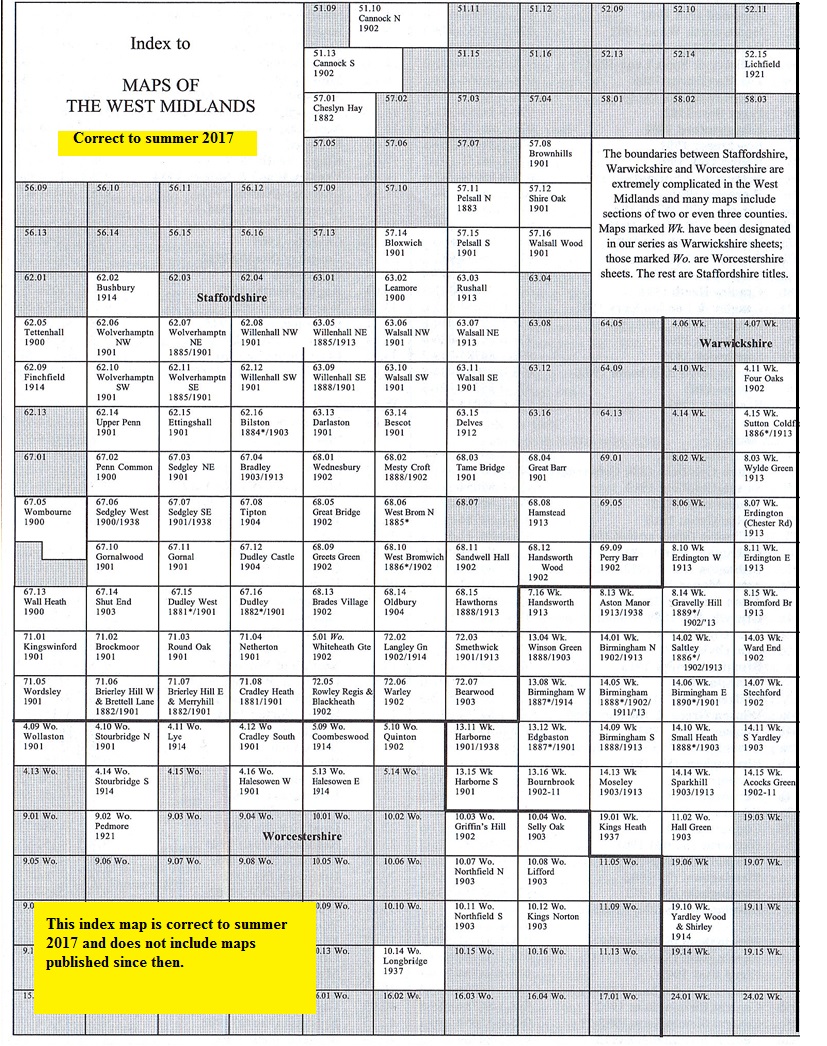
You might find this Index Map useful.
 We also publish many smaller scale "Inch to the Mile" maps. The following map covers much of the Walsall area:
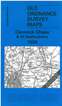
154 Cannock Chase & SE Staffordshire 1898 publ 2001; intro by John Boynton. Includes a map of
Cheslyn Hay on the reverse.
For details and index maps of this series visit the One Inch page.
 Follow the following links for maps in Dudley, Walsall, Wolverhampton,
Birmingham or here for all the Birmingham and Black Country titles..
Most maps in the Godfrey Edition are taken from the 25 inch to the mile map and reduced to about 15 inches to the mile.
For a full list of English maps, return to the England page
You can order maps direct from our On-line Mapshop.
This list shows all the principal maps for the borough. We try to keep a full range in print but inevitably some titles fall out of print from time to time.
These are noted in our On-line Mapshop.
Follow the following links for maps in Dudley, Walsall, Wolverhampton,
Birmingham or here for all the Birmingham and Black Country titles..
Most maps in the Godfrey Edition are taken from the 25 inch to the mile map and reduced to about 15 inches to the mile.
For a full list of English maps, return to the England page
You can order maps direct from our On-line Mapshop.
This list shows all the principal maps for the borough. We try to keep a full range in print but inevitably some titles fall out of print from time to time.
These are noted in our On-line Mapshop.
Alan Godfrey Maps, Prospect Business Park, Leadgate, Consett, DH8 7PW. Tel 01207 583388
The Godfrey Edition / sales@alangodfreymaps.co.uk / 5 October 2021