Old Ordnance Survey Maps of Staffordshire

  • These detailed maps normally cover an area of about one and a half miles by one mile. Each map includes an introduction.
  • They are available through our On-line Mapshop

  • Here are the details of maps for Brownhills:

  • Staffordshire Sheet 57.08 Brownhills & Ogley Hay 1901 - published 2002; intro by Cath Yates. ISBN.978-1-84151-438-3

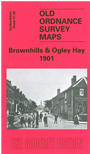
    This detailed map covers part of the Brownhills area NE of Walsall. Features include a stretch of the LNWR railway with Brownhills station, a stretch of the MR Walsall Wood Extension with its Brownhills station, St James church, wharf, Ogley Square, Brownhills Mill, Middleton House, Watling Street, St Thomas church, Hussey Arms, stretches of the Anglesey Branch and Wyrley & Essington canals, chemical works, New Town, Anglesey Sidings, Anglesey Bridge etc. We include directories of Brownhills and Ogley Hay on the reverse.

    The map links up with sheets 57.12 Shire Oak to the south.


  • For a list of local maps, please go to the Walsall or West Midlands page.
  • You can order maps direct from our On-line Mapshop. For other information and prices, and other areas, go to The Index Page.
  • Maps in the Godfrey Edition are taken from the 25 inch to the mile map and reduced to about 15 inches to the mile. For a full list of maps for England, return to the England page.
    Alan Godfrey Maps, Prospect Business Park, Leadgate, Consett, Co Durham, DH8 7PW / sales@alangodfreymaps.co.uk / 28 January 2018