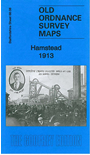
Staffordshire 68.08 Hamstead 1913 - published 2012; intro by Michael Jee. ISBN.978-1-84784-559-7 
This detailed map covers the Hamstead area, part of Perry Barr. Features include railway with Great Barr station, Hamstead Colliery, Hamstead Brick Works, Tame Valley Canal, industrial tramways etc.
On the reverse we include a timetable for the Birmingham-Walsall/Wolverhampton line in 1897.
The map links up with Staffordshire sheet 68.04 Great Barr to the north, 68.12 Handsworth Wood to the south.
For a full list of maps of local maps, please go to the Birmingham page or to the Walsall page.
You can order maps direct from our On-line Mapshop.
For other information and prices, and other areas, go to The Index Page.
Maps in the Godfrey Edition are taken from the 25 inch to the mile map and reduced to about 15 inches to the mile.
For a full list of maps for England, return to the England page.
Alan Godfrey Maps, Prospect Business Park, Leadgate, Consett, Co Durham, DH8 7PW / sales@alangodfreymaps.co.uk / 28 January 2018

 Here are the details of maps for Hamstead: