Old Ordnance Survey Maps of Staffordshire

  • These detailed maps normally cover an area of about one and a half miles by one mile. Each map includes an introduction.
  • They are available through our On-line Mapshop

  • Here are the details of maps for Pelsall (North):

  • Staffordshire Sheet 57.11 Pelsall (North) 1883 - published 1995; intro by A Tomkinson. ISBN.978-0-85054-729-0

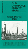
    This detailed map covers much of north Pelsall, an area that was semi-rural in the 1880s. However, there is a good smattering of industry and transport interest. Features include Pelsall Colliery (shafts 8, 9 and 10), Ryder's Hay Crossing and Sidings, section of LNWR line incl Norton Junction, Highbridge Row, Railway Colliery Hotel, Wyrley & Essington Canal, Pelsall Iron Works, Moat Farm, old coal shafts, Gilpin's Arm etc. On the reverse we include about half of the 1901 map for the area, covering the area around Pelsall Common.

    The map links up with sheets 57.12 Shire Oak to the east, 57.15 Pelsall South to the south.


  • For a list of local maps, please go to the Walsall or West Midlands page.
  • You can order maps direct from our On-line Mapshop. For other information and prices, and other areas, go to The Index Page.
  • Maps in the Godfrey Edition are taken from the 25 inch to the mile map and reduced to about 15 inches to the mile. For a full list of maps for England, return to the England page.
    Alan Godfrey Maps, Prospect Business Park, Leadgate, Consett, Co Durham, DH8 7PW / sales@alangodfreymaps.co.uk / 28 January 2018