 Old Ordnance Survey Maps of Sussex
 Here is our selection of maps for Sussex. All include an introduction to the history
of the area and most also include extracts from an early directory. Coverage includes the major seaside towns of Bognor (before it became Bognor Regis), Brighton and Worthing; the
cathedral city of Chichester; Lewes, Petworth and Rye, each of them steeped in history; Haywards Heath and Three Bridges, which
developed as major commuter centres on the growth of the railways. Lots of variety here. Further information about individual maps is given on our
On-line Mapshop.
Here is our selection of maps for Sussex. All include an introduction to the history
of the area and most also include extracts from an early directory. Coverage includes the major seaside towns of Bognor (before it became Bognor Regis), Brighton and Worthing; the
cathedral city of Chichester; Lewes, Petworth and Rye, each of them steeped in history; Haywards Heath and Three Bridges, which
developed as major commuter centres on the growth of the railways. Lots of variety here. Further information about individual maps is given on our
On-line Mapshop.
 The following maps are all taken from the OS 25" maps and reduced to a scale of approximately 15 inches to the mile.
They are extremely detailed, showing individual houses, details such as railway tracks, pathways,
pubs, factories and even minutiae such as fountains and signal posts. Obviously they cover quite a small area, normally a mile
by a mile and a half each.
The following maps are all taken from the OS 25" maps and reduced to a scale of approximately 15 inches to the mile.
They are extremely detailed, showing individual houses, details such as railway tracks, pathways,
pubs, factories and even minutiae such as fountains and signal posts. Obviously they cover quite a small area, normally a mile
by a mile and a half each.
04.09 Three Bridges 1909 - published 2003; introduction by Alan A Jackson
13.08 Horsham (North) 1932 - published 2004; intro by Tony Painter
13.12 Horsham (South) 1938 - published 2004; intro by Tony Painter
21.16 Midhurst 1895 - published 2017; intro by Richard Oliver
40.04 Uckfield 1908 - published 2013; intro by Richard Oliver
22.16 Petworth 1896 - published 1996; intro by Peter Jerrome
26.10 Haywards Heath 1896 - published 1995; intro by Judy Middleton
40.04 Uckfield 1908 - published 2013; intro by Richard Oliver
45.07 Rye 1927 - published 2004; intro by Tony Painter
51.12 Steyning & Bramber 1932 - published 2017; intro by Richard Oliver
54.14 Lewes 1898 - published 1999; intro by Alan Godfrey
57.04 Battle 1937 - published 2005; intro by Tony Painter
61.07 Chichester 1896 - published 1999; intro by Alan Godfrey
61.07 Chichester 1932 - published 2014; intro by Michael Jee
61.07 Chichester (South) 1933 - published 2014; intro by Michael Jee
64.14 West Worthing 1896 - published 1995; intro by Alan Godfrey
64.15 Worthing 1896 - published 1995; intro by Alan Godfrey
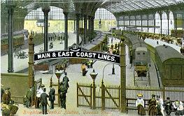
66.09 Brighton 1909 - published 2007; intro by Alan Godfrey
70.07 Bexhill-on-Sea 1908 - published 2006; intro by Alan Godfrey
71.02 Hastings (West) & St Leonards 1897 - published 2009; intro by Pamela Taylor
71.03 Hastings (Old Town) 1908 - published 2010; intro by Pamela Taylor
74.06 Bognor 1896 - published 1996; intro by Alan Godfrey
78.03 Newhaven (North) 1937 - published 2005; intro by Tony Painter
78.07 Newhaven (South) 1938 - published 2005; intro by Tony Painter
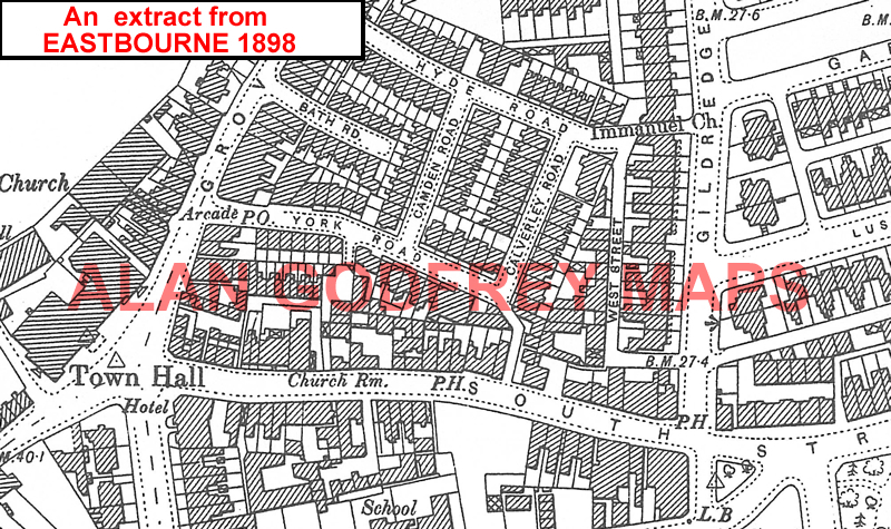
80.10 Eastbourne 1898 - published 2009; intro by Pamela Taylor
You might find this grid useful for the Battle, Bexhill and Hastings maps.
 Also in the Godfrey Edition, several of our One Inch to the Mile maps cover parts of Sussex. These cover an area of about 18 miles by 12 miles each, in less detail than our large scale maps,
but invaluable for showing villages, railways and canals, and for putting the towns into context. The
following are of especial interest to the county. Click on the links for further information.
Also in the Godfrey Edition, several of our One Inch to the Mile maps cover parts of Sussex. These cover an area of about 18 miles by 12 miles each, in less detail than our large scale maps,
but invaluable for showing villages, railways and canals, and for putting the towns into context. The
following are of especial interest to the county. Click on the links for further information.
301 Haslemere & District 1901- Published 2003, intro by Tony Painter. Includes a map of Cranleigh.
302 Horsham, Crawley & St Leonard's Forest 1901 - published 2004, intro by Tony Painter. Includes a map of Slinfold.
303 Tunbridge Wells & Ashdown Forest 1894 - published 2011; intro by Barrie Trinder. Includes a map of Mayfild.
304 Tenterden & District 1893 - published 2010; intro by Barrie Trinder. Includes a map of Hassocks.
316 Fareham, Hambledon & Havant 1894 - published 2011; intro by Barrie Trinder.
317 Arundel & District 1881 - published 2010; intro by Barrie Trinder. Includes a map of Arundel.
318 Brighton & District 1894 - published 2010; intro by Barrie Trinder. Includes a map of Westham.
319 Lewes & District 1894 - published 2010; intro by Barrie Trinder.
320/321 Winchelsea, Hastings & Dungeness 1903 - published 2004, intro by Tony Painter. Includes a detailed
map of Winchelsea.
332/333 Selsey Bill, Bognor & Worthing 1901 - published 2005, intro by Tony Painter. Includes a map of Pagham .
334 Beachy Head, Newhaven & Eastbourne 1880-1903 - published 2005; intro by Tony Painter. Includes a map of Litlington . NB. This
title includes two different dates for sheet 334, so you can see the changes from 1880 to 1903.
See the One Inch page for a complete list.
 Most maps in the Godfrey Edition are taken from the 25 inch to the mile map and reduced to about 15 inches to the mile.
For a full list of English maps, return to the England page
You can order maps direct from our On-line Mapshop.
Most maps in the Godfrey Edition are taken from the 25 inch to the mile map and reduced to about 15 inches to the mile.
For a full list of English maps, return to the England page
You can order maps direct from our On-line Mapshop.
Alan Godfrey Maps, Prospect Business Park, Leadgate, Consett, DH8 7PW. Tel 01207 583388
The Godfrey Edition / sales@alangodfreymaps.co.uk / 25 Sept 2017
 Old Ordnance Survey Maps of Sussex
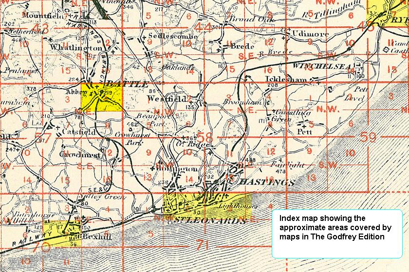