
Old Ordnance Survey Inch to the Mile Maps
These maps normally cover an area of about 18 miles by 12 miles and are especially good at showing railways, roads and canals, and at giving
a broad view of a wider area. Each includes an introduction and a more detailed map of a small town or village.
They are available through our On-line Mapshop
 Here is information about Sheet 303:
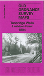
One Inch Sheet 303 Tunbridge Wells & Ashdown Forest 1894 - published 2011; intro Barrie Trinder. ISBN.978-1-84784-452-1
This Inch to the Mile map covers the area from Tunbridge Wells southward to Marefield, and from East Grinstead eastward to Lamberhurst. The map covers much of the High Weald and Ashdown Forest area. On the reverse we include a more detailed map of Mayfield.
It is not possible to list the many hamlets, farmsteads and other topographical features shown on these maps. However, you may find it useful if we list the towns and
principal villages or church parishes that are included on this map. Links are given for those for which detailed large-scale maps are also available.
Kent: Ashurst, Cowden, Lamberhurst, Pembury, Tunbridge Wells.
Sussex: Burwash, Buxted, Crowborough, East Grinstead, Eridge, Fletching, Frant, Hadlow Down, Hartfield, Maresfield, Mayfild, Rothrfield, Wadhurst.
For a full list of Inch to the Mile maps go to our One Inch page.
You can order maps direct from our On-line Mapshop.
For other information and prices, and other areas, go to The Index Page.
The Godfrey Edition / godfreyedition@btinternet.com / 9 Feb 2011