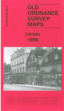
We have published more than 1,800 maps in our series of Old Ordnance Survey Map reprints, including a group in Sussex. The maps are highly detailed. They are taken from the OS 1:2,500 (or 25 inch) maps and reduced to about 15 inches to the mile. Each covers an area of a mile and a half by a mile. They show streets with individual houses, tram tracks, railway tracks and even signals, factories, wharves and such details as fountains and water troughs. They will provide hours of fascination for historians and genealogists. The maps are neatly folded and each includes a specially written introduction to the area. Maps can be purchased on our On-line Mapshop where further information about titles is given. Or visit The Index Page for a full list to the series and details of Prices.
Here are the details of maps for Lewes:
This detailed map of Lewes, the historic county town of Sussex, covers most of the town centre. Coverage then extends southward across the marshes to Southerham Farm and Southerham Junction, and eastward across the River Ouse towards the Downs. Northward the map reaches Pelham Terrace, westward St Peter's Place. Features on the map include High Street, School Hill, North Street, the castle, Cliffe High Street, Malling Street, South Malling Brewery, Southdown Brewery, South Street, Phoenix Iron Works, St Thomas a Becket church, All Saints church, St John's church, remains of St Pancras priory, station, the complex of railway junctions. On the reverse we include extracts from the directory of 1905 listing private residents.
Follow this link for a complete list of our Sussex Series maps.
You can order maps direct from our On-line Mapshop. For other information and prices, and other areas, go to The Index Page.
Maps in the Godfrey Edition are taken from the 25 inch to the mile map and reduced to about 15 inches to the mile. For a full list of maps for England, return to the England page.
The Godfrey Edition / godfreyedition@btinternet.com / 4 December 2005