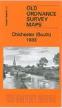
Sussex Sheet 61.11 Chichester (South) 1933 - published 2014; intro by Michael Jee. ISBN 978-1-84784-823-9 
This detailed map gives good coverage of the souther part of Chichester, from the railway southward.
Features include railway with station, West Sussex Railway (Selsey Tramway), Rumboldswhyke, Chichester Canal, Whyke Gravel Pits,
St Rumbold's church, convent, Peckham's Copse Farm, Vinnetrow Farm, etc. We include directory extracts on the reverse.
The map links up with sheet 61.07 Chichester to the north.
Follow these links for complete lists of our West Sussex and East Sussex maps.
You can order maps direct from our On-line Mapshop.
For other information and prices, and other areas, go to The Index Page.
Most maps in the Godfrey Edition are taken from the 25 inch to the mile map and reduced to about 15 inches to the mile.
For a full list of maps for England, return to the England page.
The Godfrey Edition / sales@alangodfreymaps.co.uk / 1 December 2016
 Here are the details of the map for south Chichester: