
 Here is information about Sheet 334:
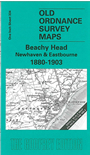
The index map may suggest that this is rather an empty map, showing a small area of coastline. In fact this gives us space to include two different editions of the same map, for 1880 and 1903 respectively. As the maps are next to each other it is fascinating to explore the topographical and cartographic changes between the two maps; for instance, the Martello towers on the coast are excluded from the earlier map, presumably for security reasons, but are shown on the 1903 version. Eastbourne has also become a much larger town by the time of the second map. Coverage stretches from Newhaven to Eastbourne and a little beyond, and inland to Willingdon. Tony Painter gives a full and readable history of the area. On the back we include a detailed map of the village of Litlington.
It is not possible to list the many hamlets, farmsteads and other topographical features shown on these maps. However, you may find it useful if we list the towns and principal villages or church parishes that are included on this map. Links are given for those for which detailed large-scale maps are also available.
Index maps are available showing the areas covered by the Inch to the Mile maps. Go to This page
You can order maps direct from our On-line Mapshop. For a full list of Inch to the Mile maps go to the Inch to the Mile page, where you will also find details of prices. For information on the rest of the series, go to The Index Page.