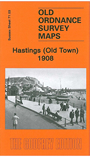
Sussex Sheet 71.03 Hastings (Old Town) 1908 - published 2010; intro by Pamela Taylor. ISBN.978-1-84784-373-9 
This detailed map covers the eastern part of Hastings, the 'Old Town', with coverage extending eastward to Ecclesbourne Coastguard Station; and northward to Collier Road.
Features include Harbour, West Hill, Croft House, breakwater, All Saints church, Old Hastings House, High Street, Tackleway, All Saints Street, George Street area. Directory entries G-O are included on the reverse.
The map links up with sheet 71.02 Hastings West to the west.
Follow these links for complete lists of our West Sussex and East Sussex maps.
You can order maps direct from our On-line Mapshop.
For other information and prices, and other areas, go to The Index Page.
Most maps in the Godfrey Edition are taken from the 25 inch to the mile map and reduced to about 15 inches to the mile.
For a full list of maps for England, return to the England page.
The Godfrey Edition / sales@alangodfreymaps.co.uk / 1 December 2016
 Here are the details of the map for east Hastings: