
 Here is information about Sheet 302:
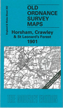
This Inch to the Mile map covers part of north Sussex, with a small portion of Surrey at the top. Coverage stretches from Slinfold eastward to the outskirts of East Grinstead, and from Charlwood southward to Haywards Heath. The 'Bluebell Railway' runs down the eastern side. The area known as St Leonard's Forest is in the centre of the map. On the back we include a larger scale map of the village of Slinfold, complete with directory.
It is not possible to list the many hamlets, farmsteads and other topographical features shown on these maps. However, you may find it useful if we list the towns and principal villages or church parishes that are included on this map. Links are given for those for which detailed large-scale maps are also available.
Index maps are available showing the areas covered by the Inch to the Mile maps. Go to This page
You can order maps direct from our On-line Mapshop. For a full list of Inch to the Mile maps go to the Inch to the Mile page, where you will also find details of prices. For information on the rest of the series, go to The Index Page.