Old Ordnance Survey Maps of East Sussex

  • These detailed maps normally cover an area of about one and a half miles by one mile. Each map includes an introduction.
  • They are available through our On-line Mapshop

  • Here are the details of the map for Rye:

  • Sussex Sheet 45.07 Rye 1927 - published 2004; intro by Tony Painter. ISBN.978-1-84151-652-3

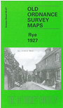
    This detailed map of Rye, famed for its connection with Henry James, covers the town centre, the area northward to Rye Hill and Point Hill, and extends eastward across the Salts Marsh Embankment Land to the hamlet of East Guldeford. Features include the railway station, St Mary's church, Rock Channel shipyard, The Quay, High Street, Gateborough, Cinque Ports Street, Town Salts, Middle Salts, North Salts, Poor Law Institution, terminus and a stretch of Rye & Camber Tramway, Guldeford Road. On the reverse is a commercial directory for Rye in 1905.

    You might find this index map useful.


  • Follow these links for complete lists of our West Sussex and East Sussex maps.
  • You can order maps direct from our On-line Mapshop. For other information and prices, and other areas, go to The Index Page.
  • Most maps in the Godfrey Edition are taken from the 25 inch to the mile map and reduced to about 15 inches to the mile. For a full list of maps for England, return to the England page.
    The Godfrey Edition / sales@alangodfreymaps.co.uk / 1 December 2016