OLD ORDNANCE SURVEY MAPS
For Ireland
So far we have published more than 50 maps for Ireland. Most of these
maps were originally prepared around the turn of the century. As a result all Irish
maps, north and south, are here listed as one series.
The following Maps are highly detailed, taken from the 1/2500 plans and
reprinted at about 14 inches to the mile. The Dublin Castle map is even
more detailed, at a yard to the mile.
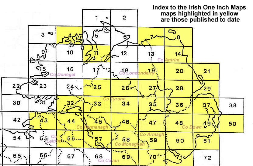
One Inch to the Mile Maps
These maps are small scale district maps at one inch to the mile
but each has one or more large scale plans of small towns or
villages on the back.
 Most maps in the Godfrey Edition are taken from the 25 inch to the mile map and reduced to about 15 inches to the mile.
For a full list of Irish maps, return to the Ireland page
You can order maps direct from our On-line Mapshop.
Most maps in the Godfrey Edition are taken from the 25 inch to the mile map and reduced to about 15 inches to the mile.
For a full list of Irish maps, return to the Ireland page
You can order maps direct from our On-line Mapshop.
Alan Godfrey Maps, Prospect Business Park, Leadgate, Consett, DH8 7PW. Tel 01207 583388
The Godfrey Edition / sales@alangodfreymaps.co.uk / 27 December 2024