 Here are the details of maps for Manorhamilton:

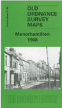
This detailed map is double-sided for maximum coverage. Most of the town of Manorhamilton is shown, and coverage extends eastward to Curley Bridge and the station.
The main map covers the Main Street area of town, where features also include church, ruined church, Sycamore Lodge, Owenmore River, St Clare's Hall, Workhouse, railway with station, engine shed and full track layout, part of Donagh More district, Ramooney district, Curley Bridge. On the reverse is part of adjacent sheet 7.16 extending coverage north, and this includes Fair Green, ruined castle, St Clare's RC church, Sheela More's Bridge, Bee Park. Skreeny House is just cut off by the margin. We also include a trade directory for Manorhamilton in c.1910.