Old Ordnance Survey Maps of County Armagh
Although we have published only a few large scale maps for Co Armagh, we cover most of the county in our Inch to the Mile series.
They are available through our On-line Mapshop.
 These are the detailed maps currently available in our Co Armagh series.
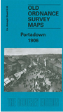
Sheet 9.08 Portadown 1906 - published 2004, intro by Alan Godfrey
Town plans Bessbrook, Crossmaglen & Keady 1906 - published 1986. Now out of print
We are also publishing a series of Inch to the Mile maps for Ulster, and the following titles cover parts of Co Armagh:
Sheet 35 Coalisland, Dungannon & District 1899 - published 2010.
Sheet 36 Belfast & Hillsborough 1901 - published 2009 (covers small area of Co Armagh around Lurgan).
Sheet 46 Augher, Clogher, Aughnacloy 1902 - published 1989. Includes detailed maps of all three towns.
Sheet 47 Armagh, Tandragee & District 1900 - published 2010. Includes detailed map of Tandragee.
Sheet 59 Keady, Castleblayney & Bessbrook 1900 - published 2009. Includes a detailed map of Keady.
Sheet 70 Carrickmacross, Dundalk & Crossmaglen 1900 - published 2010
 Most maps in the Godfrey Edition are taken from the 25 inch to the mile map and reduced to about 15 inches to the mile.
For a full list of Irish maps, return to the Ireland page
You can order maps direct from our On-line Mapshop.
Most maps in the Godfrey Edition are taken from the 25 inch to the mile map and reduced to about 15 inches to the mile.
For a full list of Irish maps, return to the Ireland page
You can order maps direct from our On-line Mapshop.
Alan Godfrey Maps, Prospect Business Park, Leadgate, Consett, DH8 7PW. Tel 01207 583388
The Godfrey Edition / sales@alangodfreymaps.co.uk / 14 January 2018