
Old Ordnance Survey Maps of Dorset
We have a range of detailed maps for Dorset towns and we also cover the whole county at the Inch to the Mile scale.
Here are the details.
All maps are available from our On-line Mapshop.
Dorset County Council was formed in 1889. Bournemouth and Christchurch were transferred from Hampshire to Dorset in 1974.
See This Page for a summary of the county's local government history.
 These are the maps we publish for Dorset:
03.08 Gillingham 1900 - published 1990; intro by Alan Godfrey
04.14 Shaftesbury 1900 - published 1990; intro by Alan Godfrey
06.13 Sherborne 1901 - published 1990; intro by Alan Godfrey
13.03 Sturminster Newton 1900- published 2005, intro by Alan Godfrey
24.07 Blandford Forum 1901 - published 1990; intro by Jo Draper
34.08 Wimborne Minster 1900 - published 1990; intro by Alan Godfrey
38.10 Bridport 1901 - published 1990; intro by Paul Hyland
40.15a Dorchester 1886 - published 2012; intro by Tony Painter  40.15b Dorchester 1901 - published 1990; intro by Jo Draper
43.16a Poole 1887 - published 2012; intro by Tony Painter
43.16b Poole 1900 - published 1990; intro by Paul Hyland Out of print
53.10 Weymouth Westham 1901 - published 1993; intro by Maureen Attwooll
53.11 Weymouth 1901 - published 1993; intro by Maureen Attwooll
53.14 Wyke Regis 1901 - published 1993; intro by Maureen Attwooll
57.09 Swanage 1900 - published 1990; intro by Paul Hyland
58.07 Isle of Portland: Castletown 1927 - published 1990; intro by Alan Godfrey Temporarily out of print
58.11 Isle of Portland: Fortuneswell & Grove 1927 published 1991; intro by Alan Godfrey
58.15 Isle of Portland: Easton & Weston 1927 - published 1991; intro by Stuart Morris
60.03 Isle of Portland: Southwell 1926 - published 1992; intro by Stuart Morris
40.15b Dorchester 1901 - published 1990; intro by Jo Draper
43.16a Poole 1887 - published 2012; intro by Tony Painter
43.16b Poole 1900 - published 1990; intro by Paul Hyland Out of print
53.10 Weymouth Westham 1901 - published 1993; intro by Maureen Attwooll
53.11 Weymouth 1901 - published 1993; intro by Maureen Attwooll
53.14 Wyke Regis 1901 - published 1993; intro by Maureen Attwooll
57.09 Swanage 1900 - published 1990; intro by Paul Hyland
58.07 Isle of Portland: Castletown 1927 - published 1990; intro by Alan Godfrey Temporarily out of print
58.11 Isle of Portland: Fortuneswell & Grove 1927 published 1991; intro by Alan Godfrey
58.15 Isle of Portland: Easton & Weston 1927 - published 1991; intro by Stuart Morris
60.03 Isle of Portland: Southwell 1926 - published 1992; intro by Stuart Morris
The following maps also covers Dorset towns:
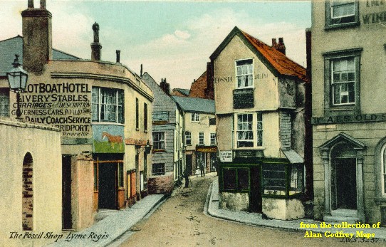
Devon 84.07 Lyme Regis 1903 - published 1997; intro by Alan Godfrey
We have a small group for Bournemouth & Christchurch, now part of Dorset, but historically Hampshire towns:
86.09 Bournemouth (North) 1922 - published 1991, revised 2014; intro by Alan Godfrey
86.10 Boscombe & Pokesdown 1923 - published 1991; intro by Alan Godfrey
86.12 Christchurch 1896 - published 1997; intro by Alan Godfrey
86.13 Central Bournemouth 1923 - published 1992; intro by Alan Godfrey
We also cover Dorset in our Inch to the Mile series. These are the principal sheets for the county:
297 Wincanton, Mere & District 1897- published 2009; intro by Tony Painter. Includes a map of Zeals
312 SE Somerset 1899 - published 2008; intro by Tony Painter. Includes a map of South Petherton
313 The Blackmore Vale 1903 - published 2006; intro by Alan Godfrey. Includes a map of Stalbridge.
314 Cranborne Chase 1894 - published 2010; intro by Tony Painter. Includes a map of Berwick St John
327 Beaminster, Bridport & Wewst Dorset 1905 - published 2010; intro by Tony Painter. Includes a map of Beaminster.
328 Dorchester, Puddleton & District 1903 - published 2010; intro by Tony Painter. Includes maps of Puddletown and Tolpuddle.
329 Poole Harbour & Bournemouth 1893 - published 2000; intro by Jude James. Includes a map of Hinton Admiral.
341/342 Portland & Weymouth 1912 - published 2007; intro by Alan Godfrey. Includes a map of Lulworth Cove
343 Corfe Castle & SE Purbeck 1895 - published 2010; intro by Tony Painter. Includes a map of Corfe Castle.
For further details visit the One Inch page
 Most maps in the Godfrey Edition are taken from the 25 inch to the mile map and reduced to about 15 inches to the mile.
For a full list of English maps, return to the England page
You can order maps direct from our On-line Mapshop.
Most maps in the Godfrey Edition are taken from the 25 inch to the mile map and reduced to about 15 inches to the mile.
For a full list of English maps, return to the England page
You can order maps direct from our On-line Mapshop.
Alan Godfrey Maps, Prospect Business Park, Leadgate, Consett, DH8 7PW. Tel 01207 583388
The Godfrey Edition / sales@alangodfreymaps.co.uk / 12 January 2018
 These are the maps we publish for Dorset: