Dorset Sheet 57.09 Swanage 1900 - published 1990; intro by Paul Hyland. ISBN.978-0-85054-347-6 
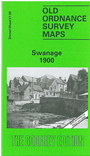
This detailed map covers the popular seaside resort of Swanage. Coverage extends from the coast and Peveril Point westward to
Herston and northward to Caldron Barn Farm, about half a mile north of the town. Features include the town centre, station, pier, High Street, Newton Manor,
Herston incl St Mark's church, Purbeck stone quarries, St Mary's church, St Aldhem's church, Prospect Farm. There is a directory
on the reverse.
Follow this link for a complete list of our Dorset Series maps.
You can order maps direct from our On-line Mapshop.
For other information and prices, and other areas, go to The Index Page.
Maps in the Godfrey Edition are taken from the 25 inch to the mile map and reduced to about 15 inches to the mile.
For a full list of maps for the South West, return to the South West page.
The Godfrey Edition / sales@alangodfreymaps.co.uk / 12 January 2018

 Here are the details of maps for Swanage: