Old Ordnance Survey Maps of Bridport


We have published more than 1,800 maps in our series of Old Ordnance Survey Map reprints, including a group in Dorset. The maps are highly detailed. They are taken from the OS 1:2,500 (or 25 inch) maps and reduced to about 15 inches to the mile. Each covers an area of a mile and a half by a mile. They show streets with individual houses, tram tracks, railway tracks and even signals, factories, wharves and such details as fountains and water troughs. They will provide hours of fascination for historians and genealogists. The maps are neatly folded and each includes a specially written introduction to the area. Maps can be purchased on our On-line Mapshop where further information about titles is given. Or visit The Index Page for a full list to the series and details of Prices.


  • Here are the details of maps for Bridport:

  • Dorset Sheet 38.10 Bridport 1901 - published 1990; introduction by Paul Hyland

    This detailed map is double-sided to provide maximum coverage. On the main map the town centre is in the top left corner, with West Street, East Street and South Street. St Swithin's church is at the left edge. Coverage extends south to Wanderwell and Bothenhampton, and eastward to Hyde and Walditch. Features include St Mary's church, East Street station, Bridport Old Brewery, South Mills, Priory Mills, Court Mills, St Michael's Foundry, St Andrew's church, workhouse, Asker Mills. At Bothenhampton features include Holy Trinity church, Manor Farm, Hyde Hill, St Mary's church at Walditch, Walditch Knap. On the reverse we include half of sheet 38.14 extending coverage southward to West Bay, including station, piers, Bridport Harbour, West Bay Hotel, coastguard station.

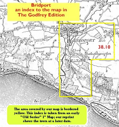
    You might find this index map useful.


    Follow this link for a complete list of our Dorset Series maps.

    You can order maps direct from our On-line Mapshop. For other information and prices, and other areas, go to The Index Page.


    Maps in the Godfrey Edition are taken from the 25 inch to the mile map and reduced to about 15 inches to the mile. For a full list of maps for the South West, return to the South West page.

    The Godfrey Edition / godfreyedition@btinternet.com / 21 November 2005