We have published more than 1,800 maps in our series of Old Ordnance Survey Map reprints, including a group in Dorset. The maps are highly detailed. They are taken from the OS 1:2,500 (or 25 inch) maps and reduced to about 15 inches to the mile. Each covers an area of a mile and a half by a mile. They show streets with individual houses, tram tracks, railway tracks and even signals, factories, wharves and such details as fountains and water troughs. They will provide hours of fascination for historians and genealogists. The maps are neatly folded and each includes a specially written introduction to the area. Maps can be purchased on our On-line Mapshop where further information about titles is given. Or visit The Index Page for a full list to the series and details of Prices.
Here are the details of maps for Sturminster Newton:
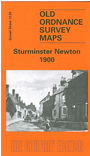
Detailed coverage of this small but once busy market town, in the heart of the Blackmore Vale. The map is double-sided to give maximum coverage. The main map shows the town centre, and coverage extends north to the workhouse and beyond to Twinwood Coppice, west to River Stour and Blackwater Bridge, east to Butts Pond, Rixon and Hosey Bridge. Features include station, Market Place, St Mary's church, The Lindens, Riverside Villas (where Thomas Hardy lived). On the reverse is a large extract from sheet 13.07 extending coverage south to Town Bridge and beyond to Bridge, Broad Oak, west to Newton, SE to part of Piddles Wood. Features here include remains of castle, Newton Farm, Glue Hill, Sturminster Mill.
Follow this link for a complete list of our Dorset Series maps.
You can order maps direct from our On-line Mapshop. For other information and prices, and other areas, go to The Index Page.
Maps in the Godfrey Edition are taken from the 25 inch to the mile map and reduced to about 15 inches to the mile. For a full list of maps for the South West, return to the South West page.
The Godfrey Edition / godfreyedition@btinternet.com / 16 October 2005