Old Ordnance Survey One-Inch Maps


These maps are taken from the famous OS "Inch to the Mile" Maps. Though obviously far less detailed than the large scale maps for which we are perhaps better known, they provide an invaluable overview of a wider area, typically 18 miles across by 12 miles down. For transport historians they are invaluable for showing old railways, while all historians need them for their close depiction of topography, including parish boundaries. These maps also mean that we can offer historical coverage for small villages where a large scale map would not be commercially viable. We intend to publish the whole of England and Wales in this series. Almost 200 titles are now available and we aim to publish three new titles each month. The maps include historical notes and all (except the double-sided Tyneside title) also include a large scale map of a small town or village in the area.

The maps are neatly folded and each includes a specially written introduction to the area. Maps can be purchased on our On-line Mapshop where further information about titles is given. Visit the One Inch Page for a full list of Inch to the Mile Maps, or The Index Page for a full list to the series and details of Prices.

Here is information about Sheet 85:

  • One Inch Sheet 85 Manchester & District 1896 - published 1999; introduction by Chris Makepeace

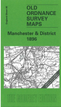
    This Inch to the Mile map is the perfect accompaniment to the growing series of detailed, large-scale maps we are publishing for the Manchester area, for it helps to put them into context, and shows how one town relates to another, and how the railways, many long since closed, linked different communties together. It covers Manchester and the area to the north. Coverage stretches from Tyldesley eastward to Stalybridge, and from Bury southward to Levenshulme and Hyde. Apart from Manchester itself, major towns covered include Bolton, Bury, Oldham and Salford, and numerous other smaller towns are included, as listed below. The southern part of Rochdale is also shown. On the reverse we include a detailed map of the village of Birch. Although the map is predominantly Lancashire, small areas of Yorkshire and Cheshire creep in at the eastern edge.


    It is not possible to list the many hamlets, farmsteads and other topographical features shown on these maps. However, you may find it useful if we list the towns and principal villages or church parishes that are included on this map. Links are given for those for which detailed large-scale maps are also available.

  • Cheshire: Hyde, Newton, Stalybridge.
  • Lancashire: Ainsworth, Alt, Ashton under Lyme, Astley, Barton upon Irwell, Blackley, Bolton, Bradshaw, Breightmet, Bury, Castleton, Chadderton, Clifton with Salwick, Darcy Lever, Denton, Droylsden, Eccles, Failsworth, Farnworth, Flixton, Gorton, Halliwell, Haughton, Heywood, Hurst, Kearsley, Levenshulme, Little Hulton, Little Lever, Manchester, Middleton, Milnrow, Moston, Oldham, Prestwich, Radcliffe, Royton, Salford, Stretford, Swinton, Tottington, Tyldesley, Urmston, Walkden, Worsley.

    For a full list of Inch to the Mile maps go to the One Inch Page; or for Lancashire large scale maps go to the North West page.

    You can order maps direct from our On-line Mapshop. For other information and prices, and other areas, go to The Index Page.


    The Godfrey Edition / godfreyedition@btinternet.com / 18 December 2005