
This is our coverage of Oldham. Oldham itself is historically in Lancashire and was made a municipal borough in 1849 and a county borough in 1889. The present Oldham Metropolitan Borough was created in 1974 with the amalgamation of the County Borough of Oldham with Chadderton Urban District, Crompton Urban District, Failsworth Urban District, Lees Urban District and Royton Urban District, all in Lancashire, plus Saddleworth Urban District from the West Riding of Yorkshire. At the same time it became one of the ten metropolitan boroughs in the new metropolitan county of Greater Manchester. It is now a unitary authority.
All maps are available from our On-line Mapshop.
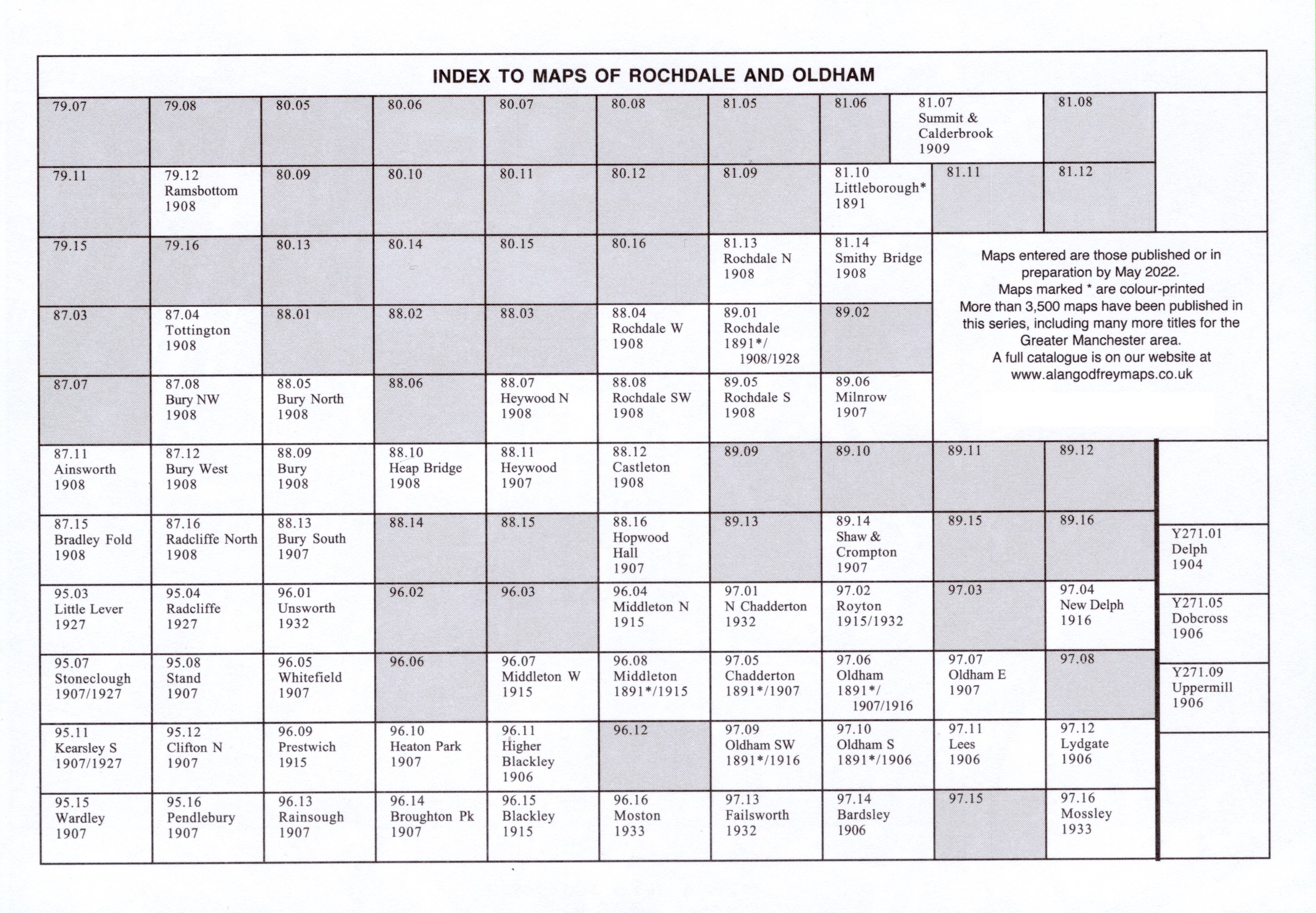
The following titles are taken from the OS 25" maps and reduced to a scale of approximately 14 inches to the mile. Each covers an area of a mile and a half by one mile, and includes an introduction.
Lancashire sheets:

Yorkshire sheets:
Here is an Index Map for our Oldham maps.
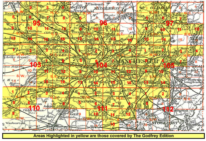 Click on the thumbnail right for an index map for the Manchester area maps in our
Lancashire series.
Click on the thumbnail right for an index map for the Manchester area maps in our
Lancashire series.
We also publish a series of smaller scale Inch to the Mile maps. Much of the area is covered by the following map:
For full details of this series visit the One Inch page.
