
 Here are the details of maps for Chadderton (N):

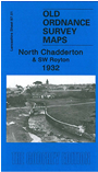
This detailed map covers North Chadderton and SW Royton, with a small portion of Oldham around the Boundary Park football ground. Coverage stretches from Chadderton Fold eastward to St Paul's church, Royton, and from Royton cricket ground southward to Fernhurst Mill. Areas include Holden Fold, Street Bridge, Haggate, Royley, Healds Green, Chadderton Fold, Buckley Wood. Features include Vine Mill, Grape Mill, Shiloh Mills, Elk Mill, Spa Mill, Downey House, Burnley Lane Farm, Broadway, Logwood Mill, Chadderton Hall, St Matthew's church, Chadderton Heights, Racefield Smallpox Hospital, River Irk. On the reverse we include a Royton telephone directory from the Royton Annual 1932.
The map links up with sheets 97.02 Royton to the north, 97.05 Chadderton to the south.