
Old Ordnance Survey Maps of Staffordshire
These detailed maps normally cover an area of about one and a half miles by one mile. Each map includes an introduction.
They are available through our On-line Mapshop.
These are the maps in today's Staffordshire County. They are taken from the OS 25" maps and reduced to a scale of approximately
15 inches to the mile. They are extremely detailed, showing individual houses, details such as railway tracks, pathways,
pubs, factories and even minutiae such as fountains and signal posts. Each covers an area a mile by a mile and a half and includes an introduction.
 These are the maps in today's Staffordshire:
08.09 Leek (West) 1923 - published 2015; intro by Barrie Trinder
08.10 Leek (East) 1923 - published 2015; intro by Barrie Trinder
19.10 Cheadle 1922 - publ 2024; intro by Barrie Trinder
20.09 Alton & Alton Towers 1920 - publ 2024; intro by Barrie Trinder
24.14 Stone (North) 1900 - publ 2022; intro by Alan Godfrey
30.02 Stone (South) 1900 - publ 2022; intro by Alan Godfrey
32.02 Uttoxeter 1900 - publ 2008; intro by Barrie Trinder
37.11a Stafford 1879 - published 2011; intro by Derrick Pratt
37.11b Stafford 1900 - published 1988; intro by Joan Anslow
40.12a Burton-on-Trent (N) 1882 - publ 2011; intro by Barrie Trinder  40.12b Burton-on-Trent (N) 1900 - publ 1988; intro by John Challen
40.16a Burton-on-Trent (S) 1882 - publ 2012; intro by Barrie Trinder
40.16b Burton on Trent (S) 1900 - publ 1988, 2nd Ed 2002; intro by Alan Godfrey
41.09 Burton-on-Trent (E) with Winshill & Stapenhill 1882 - publ 2011; intro by Barrie Trinder
45.08 Rugeley (North) 1921 - publ 2024; intro by Barrie Trinder
45.12 Rugeley (South) 1921 - publ 2024; intro by Barrie Trinder
50.03 Penkridge 1921 - publ 2024; intro by Barrie Trinder
51.06 Hednesford 1915 - publ 2023; intro by Barrie Trinder
51.10 Cannock (North) 1902 - publ 1996; intro by Charles Goodwin
51.13 Cannock (South) 1902 - publ 1996; intro by Charles Goodwin
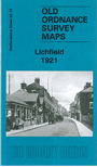
52.15 Lichfield 1921 - publ 2010; intro by Malcolm Nixon
57.01 Cheslyn Hay 1882 - publ 2010; intro by Malcolm Nixon
59.11 Tamworth 1900 - publ 1900; intro by Mabel Swift
67.05 Wombourne 1900 - publ 2000; intro by Angus Dunphy
40.12b Burton-on-Trent (N) 1900 - publ 1988; intro by John Challen
40.16a Burton-on-Trent (S) 1882 - publ 2012; intro by Barrie Trinder
40.16b Burton on Trent (S) 1900 - publ 1988, 2nd Ed 2002; intro by Alan Godfrey
41.09 Burton-on-Trent (E) with Winshill & Stapenhill 1882 - publ 2011; intro by Barrie Trinder
45.08 Rugeley (North) 1921 - publ 2024; intro by Barrie Trinder
45.12 Rugeley (South) 1921 - publ 2024; intro by Barrie Trinder
50.03 Penkridge 1921 - publ 2024; intro by Barrie Trinder
51.06 Hednesford 1915 - publ 2023; intro by Barrie Trinder
51.10 Cannock (North) 1902 - publ 1996; intro by Charles Goodwin
51.13 Cannock (South) 1902 - publ 1996; intro by Charles Goodwin
52.15 Lichfield 1921 - publ 2010; intro by Malcolm Nixon
57.01 Cheslyn Hay 1882 - publ 2010; intro by Malcolm Nixon
59.11 Tamworth 1900 - publ 1900; intro by Mabel Swift
67.05 Wombourne 1900 - publ 2000; intro by Angus Dunphy
Visit this page for maps of the Potteries.
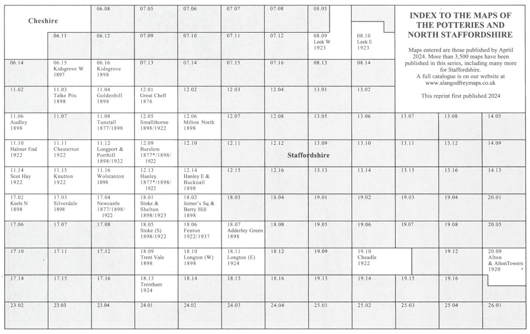
Here is an index map for The Potteries and North Staffs maps.
 We also cover the area in our Inch to the Mile series. These are the principal sheets for the county:
110 Macclesfield & District 1898 - publ 2008; intro by Derrick Pratt
111 The White Peak 1906 - publ 2002; intro by Derek Brumhead.
123 The Potteries 1895 - publ 2005; intro by Malcolm Nixon.
124 Ashbourne & District 1895 - publ 2008; intro by Barrie Trinder
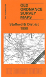
139 Stafford & District 1898 - publ 2006; intro by Barrie Trinder
140 Uttoxeter, Burton & District 1905 publ 2004; intro by Malcolm Nixon. Includes a map
of Weston upon Trent.
153 Wolverhampton & Ironbridge 1898 publ 2001; intro by Barrie Trinder. Includes a map of Penkridge.
154 Cannock Chase & SE Staffordshire 1898 publ 2001; intro by John Boynton. Includes a map
of Cheslyn Hay.
167 Dudley, Bridgnorth &amop; District 1898 publ 2008; intro by Barrie Trinder. Includes a map of Trysull.
For a full list and index maps visit the One Inch page.
 Most maps in the Godfrey Edition are taken from the 25 inch to the mile map and reduced to about 15 inches to the mile.
For a full list of English maps, return to the England page
Most maps in the Godfrey Edition are taken from the 25 inch to the mile map and reduced to about 15 inches to the mile.
For a full list of English maps, return to the England page
You can order maps direct from our On-line Mapshop.
Alan Godfrey Maps, Prospect Business Park, Leadgate, Consett, DH8 7PW. Tel 01207 583388
The Godfrey Edition / sales@alangodfreymaps.co.uk / 27 May 2024