
 Here is information about Sheet 154:
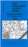
This One Inch to the Mile map covers an area of south Staffordshire centred on the cathedral city of Lichfield. Coverage stretches from Cannock and Willenhall eastward to Tamworth and Lullington, and from Alrewas southward to Walsall. The map provides an excellent accompaniment to the more detailed, large scale maps we have published for Walsall, helping put them into context. Although most of the map is Staffordshire, there are also small sections of Derbyshire and Warwickshire to the east. For transport historians many railways and canals are shown, including colliery railways in the Cannock area. On the back we include an extract from Staffs Sheet 57.01, showing Cheslyn Hay in 1900, complete with a commercial directory.
It is not possible to list the many hamlets, farmsteads and other topographical features shown on these maps. However, you may find it useful if we list the towns and principal villages or church parishes that are included on this map. Links are given for those for which detailed large-scale maps are also available.
Index maps are available showing the areas covered by the Inch to the Mile maps. Go to This page
You can order maps direct from our On-line Mapshop. For a full list of Inch to the Mile maps go to the Inch to the Mile page, where you will also find details of prices. For information on the rest of the series, go to The Index Page.