Old Ordnance Survey Maps of Staffordshire

  • These detailed maps normally cover an area of about one and a half miles by one mile. Each map includes an introduction.
  • They are available through our On-line Mapshop

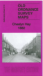
  • Here are the details of maps for Cheslyn Hay:

  • Staffordshire Sheet 57.01 Cheslyn Hay 1882 - published 2010; intro by Malcolm Nixon. ISBN.978-1-84784-435-4

    This detailed map covers the centre and north of Cheslyn Hay.

    Features include High Street area, Great Wyrley Colliery, LNWR Cannock Branch, Wyrley & Church Bridge Siding, old coal shafts, brick works, St Mark's church, Church Bridge (in top right corner of map), Urban Manure Works, Rosemary Tile Works, mineral tramways, station, Littlewood, Old Falls Farm, chapels, short stretch of Cannock Extension canal, etc. On the reverse we include 1912 directories of Cheslyn Hay and Great Wyrley.

    The map links up with Staffordshire sheet 51.13 Cannock South to the north.


  • For a full list of maps of Staffordshire county, please go to the Staffordshire page or the Potteries page.
  • You can order maps direct from our On-line Mapshop. For other information and prices, and other areas, go to The Index Page.
  • Maps in the Godfrey Edition are taken from the 25 inch to the mile map and reduced to about 15 inches to the mile. For a full list of maps for England, return to the England page.
    Alan Godfrey Maps, Prospect Business Park, Leadgate, Consett, Co Durham, DH8 7PW / sales@alangodfreymaps.co.uk / 28 January 2018