
Old Ordnance Survey Maps of North Tyneside
This is our coverage of North Tyneside. The Metropolitan Borough of North Tyneside was formed in 1974 with the amalgamation of the County Borough of Tynemouth, the Borough of Wallsend, part of the Borough of Whitley Bay, Longbenton Urban District, and part of Seaton Valley Urban District. At the same time it became part of the new county of Tyne & Wear. See This Page for a summary of the county's local government history.
All maps are available from our On-line Mapshop.
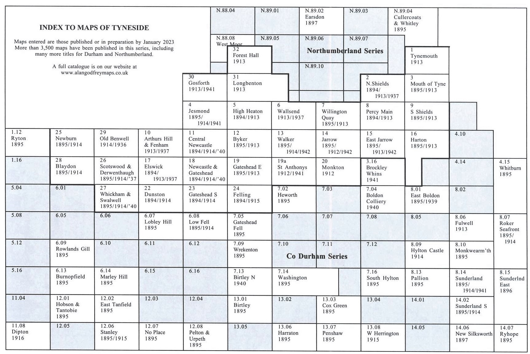
The following titles are all taken from the OS 25" maps and reduced to a scale of approximately 14 inches to the mile. Each covers an area of a mile and a half by one mile, and includes an introduction. Click on the links below for further details.
 These are our maps for North Tyneside from our Tyneside series:
