 Here are the details of maps for Tynemouth:

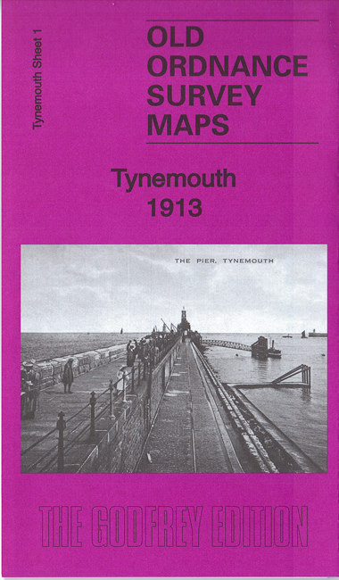
This detailed map covers the northern section of Tynemouth with coverage stretching from Donkin Terrace & Oxford Street northward to Long Sands & Bears Head Rock. Features include Prior's Park, Northumberland Park, Church of the Holy Saviour, Tynemouth Castle, North Pier, Sharpness Point and the Railway Line & Station. Main Streets on the map include part of Tynemouth Road, Percy Park Road, Grand Parade and Front Street.
This map links up with Tyneside Sheet 2 North Shields to the South-West, Tyneside Sheet 3 Mouth of the Tyne to the South and Northumberland Sheet 89.04 Cullercoats & Whitley to the North
Maps in the Godfrey Edition are taken from the 25 inch to the mile map and reduced to about 15 inches to the mile. For a full list of maps for the North East, return to the North East page.
The Godfrey Edition / sales@alangodfreymaps.co.uk / 14 March 2017