We have published more than 2,000 maps in our series of Old Ordnance Survey Map reprints, including several titles in Northumberland and a major group on Tyneside. The maps are highly detailed. They are taken from the OS 1:2,500 (or 25 inch) maps and reduced to about 15 inches to the mile. Each covers an area of a mile and a half by a mile. They show streets with individual houses, tram tracks, railway tracks and even signals, factories, wharves and such details as fountains and water troughs. They will provide hours of fascination for historians and genealogists. The maps are neatly folded and each includes a specially written introduction to the area. Maps can be purchased on our On-line Mapshop where further information about titles is given. Or visit The Index Page for a full list to the series and details of Prices.
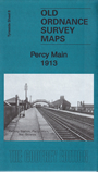
Here are the details of maps for Percy Main:
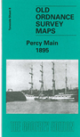
This detailed map covers the area south of North Shields and extends just as far south to include Jarrow Cement Works. The Northumberland Dock and Albert Edward Dock are a main feature on this map as are the many staiths shown around them. Other features include Northumberland Shipyard, Hayhole Leadworks, St Johns Church, Railway Line and Station, Percy Arms Public House and Readheads Shipbuilding and Engineering Works. On the reverse of the map we include an extract from a directory of 1894, and a section on the River Tyne improvement.
This map links up with Tyneside Sheet 2 North Shields to the North, Tyneside Sheet 3 Mouth of the Tyne to the North-East, Tyneside Sheet 9 South Shields to the East, Tyneside Sheet 16 Harton to the South-East and Tyneside Sheet 15 East Jarrow to the South, Tyneside Sheet 14 Jarrow to the South-West and Tyneside Sheet 7 Willington Quay to the West.
Follow this link for a complete list of our Northumberland and North Tyneside maps.
You can order maps direct from our On-line Mapshop. For other information and prices, and other areas, go to The Index Page.
Maps in the Godfrey Edition are taken from the 25 inch to the mile map and reduced to about 15 inches to the mile. For a full list of maps for the North East, return to the North East page.
The Godfrey Edition / godfreyedition@btinternet.com / 11 September 2008