Old Ordnance Survey Maps of Wolverhampton

  • These detailed maps normally cover an area of about one and a half miles by one mile. Each map includes an introduction.
  • They are available through our On-line Mapshop

  • Here are details of the map for Upper Penn:

  • Staffordshire Sheet 62.14 Upper Penn 1901 - published 1996; intro by Angus Dunphy. ISBN.978-0-85054-815-0

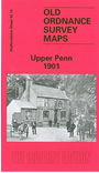
    This detailed map covers the southern part of Wolverhampton around Goldthorn Hill, with coverage extending southward to Sedgley Park and SW to Upper Penn.

    Features include St Philip's church, Coalway Farm, Upper Penn village, Muchall Hall, Muchall Grove, Manor House, Penn Court, Colton Hills, Penn Brick Works, Muchall Farm, Goldthorn Hill area, Penn Fields area, reservoirs, Goldthorn House, Sedgley Park Farm. On the reverse we include directories for Penn and Penn Fields, with street directory entries for Chequer Street, Coalway Lane, Eagle Street and Penn Road.

    The map links up with Staffordshire sheets 62.10 Wolverhampton SW to the north, 62.15 Ettingshall to the east, 67.02 Penn Common to the south.


  • Follow this link for a complete list of our Wolverhampton maps; or here for the whole West Midlands series.
  • You can order maps direct from our On-line Mapshop. For other information and prices, and other areas, go to The Index Page.
  • Maps in the Godfrey Edition are taken from the 25 inch to the mile map and reduced to about 15 inches to the mile. For a full list of maps for England, return to the England page.
    Alan Godfrey Maps, Prospect Business Park, Leadgate, Consett, Co Durham, DH8 7PW / sales@alangodfreymaps.co.uk / 27 July 2017