Old Ordnance Survey One-Inch Maps


These maps are taken from the famous OS "Inch to the Mile" Maps. Though obviously far less detailed than the large scale maps for which we are perhaps better known, they provide an invaluable overview of a wider area, typically 18 miles across by 12 miles down. For transport historians they are invaluable for showing old railways, while all historians need them for their close depiction of topography, including parish boundaries. These maps also mean that we can offer historical coverage for small villages where a large scale map would not be commercially viable. We intend to publish the whole of England and Wales in this series. Over 200 titles are now available and we aim to publish three new titles each month. The maps include historical notes and all (except the double-sided Tyneside title) also include a large scale map of a small town or village in the area.

The maps are neatly folded and each includes a specially written introduction to the area. Maps can be purchased on our On-line Mapshop where further information about titles is given. Visit the One Inch Page for a full list of Inch to the Mile Maps, or The Index Page for a full list to the series and details of Prices.

Here is information about Sheet 70:

  • One Inch Sheet 70 Mid-Airedale 1858-70 - published 1998; introduction by G C Dickinson

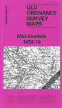
    This One Inch to the Mile map is an ideal accompaniment to the series of more detailed large scale maps we are publishing for Bradford. It covers the Airedale and Wharfedale areas north of Bradford; coverage stretches from Skipton (in the top left corner) southward to Bradford itself, and eastward to Bramhope and Bramley. Areas of interest include Ilkley Moor, Keighley Moor and the Worth Valley railway, the Leeds & Liverpool Canal and much more. Although Bradford is the largest settlement, Skipton, Keighley, Bingley and Otley are also classed as towns here by the OS - though it sees Ilkley as a village. As ever, Gordon Dickinson's introduction provides a splendidly lucid account of the area's growth. On the reverse we include a map of Bramhope.


    It is not possible to list the many hamlets, farmsteads and other topographical features shown on these maps. However, you may find it useful if we list the towns and principal villages or church parishes that are included on this map. Links are given for those for which detailed large-scale maps are also available.

  • Yorkshire: Addingham, Apperley Bridge, Baildon, Bingley, Bradford, Bramhope, Bramley, Burley in Wharfedale, Calverley, Farnley, Farsley, Guiseley, Haworth, Horsforth, Idle, Ilkley, Keighley, Kildwick, Leathley, Otley, Oxenhope, Pudsey, Shipley, Skipton, Stanningley, Weston, Yeadon.

    For a full list of Inch to the Mile maps go to the One Inch Page; or for Yorkshire large scale maps go to the Yorkshire page.

    You can order maps direct from our On-line Mapshop. For other information and prices, and other areas, go to The Index Page.


    The Godfrey Edition / godfreyedition@btinternet.com / 15 May 2007