Old Ordnance Survey Maps of Haworth


We have published more than 2,000 maps in our series of Old Ordnance Survey Map reprints, including a major group for the Yorkshire area. The maps are highly detailed. They are taken from the OS 1:2,500 (or 25 inch) maps and reduced to about 15 inches to the mile. Each covers an area of a mile and a half by a mile. They show streets with individual houses, tram tracks, railway tracks and even signals, factories, wharves and such details as fountains and water troughs. They will provide hours of fascination for historians and genealogists. The maps are neatly folded and each includes a specially written introduction to the area. Maps can be purchased on our On-line Mapshop where further information about titles is given. Or visit The Index Page for a full list to the series and details of Prices.


Here are the details of maps for Haworth:

  • Yorkshire Sheet 200.11 Haworth & Lees cum Cross Roads 1906 - published 1999; introduction by Alan Godfrey

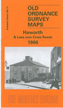
    This detailed map is double-sided for maximum coverage of the 'Bronte town'. The main map covers the lower end of the village, including the railway and station, Old Hall, Ivy Bank Mills, Bridgehouse Lane, Haworth Brow, Mill Hill, Bridgehouse Mills, Ebor Mill and Lees Mill. Coverage extends eastward along Lees Lane to the small communities of Lees, Cross Roads and Barcroft, and across Brow Moor to Flappit Spring. On the reverse we include a section of adjacent sheet 200.10 showing upper Haworth, including the church, rectory (ie the Brontes' home), Spring Head Mills, West Lane, Haworth Cemetery, Main Street, and extending westward to Sladen Bridge, Stanbury Cemetery and Lumbfoot Mill. Despite the tourist trappings a visit to Haworth can still be a moving experience and this map, albeit 100 years old, may help you understand some of the landscape away from the crowds.


    Follow this link for a complete list of our Bradford and Leedsarea maps; or here for the whole Yorkshire series.

    You can order maps direct from our On-line Mapshop. For other information and prices, and other areas, go to The Index Page.


    Maps in the Godfrey Edition are taken from the 25 inch to the mile map and reduced to about 15 inches to the mile. For a full list of maps for England, return to the England page.

    Alan Godfrey Maps, Prospect Business Park, Leadgate, Consett, Co Durham, DH8 7PW / godfreyedition@btinternet.com / 26 June 2007