
 Here are the details of maps for Harrow-on-the-Hill:

We have published two versions of this map, showing how the area changed across the years.
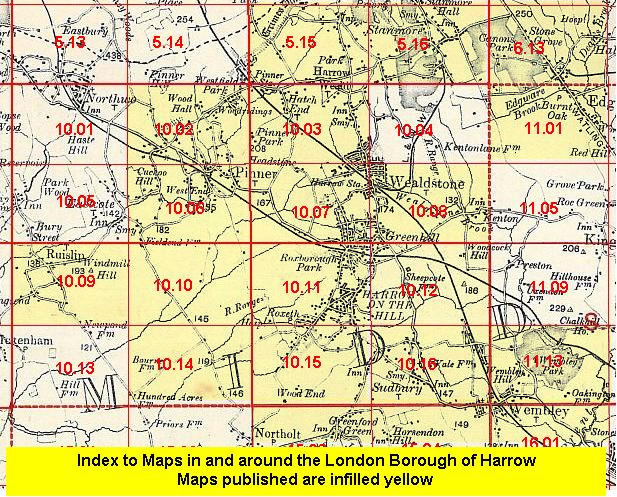
The maps cover the centre of Harrow-on-the-Hill and the area to the west, with Roxeth to the south. Coverage stretches from Harrow School westward to Imperial Drive and from Harrow-on-the-Hill station southward to Sherwood Road and Sudbury Hill. Features include Harrow School, St Mary's church, High Street, Roxeth Hill, Christ Church, Northolt Road, gasworks, Bessborough Road, West Harrow station, cricket grounds, St Peter's church, Isolation Hospital. West Harrow was being developed at the time of this map so many streets are shown under development. The map extends almost to Rayners Lane station. On the reverse we include extracts from early directories.
The map links up with Middlesex Sheets 10.07 North Harrow to the north, 10.10 Rayners Lane to the west, 10.15 South Harrow to the south, 10.12 South Kenton to the east.
 Follow this link for a list of our maps for the London Borough of Harrow, or here for a complete list of our London maps .