
 Here are the details of maps for South Harrow:

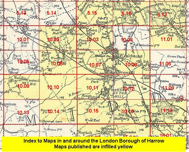
This detailed map covers the southern part of Harrow and Roxeth and northern Greenford, with coverage stretching from Eastcote Lane southward to Wadham Gardens, and from Carlyon Avenue eastward to Greenford Road. Features include part of Northolt Park racecourse, LNER railway with Northolt Park and Sudbury Hill stations, Piccadilly line with South Harrow and Sudbury Hill stations, South Hill Avenue, Orley Farm School, Alexandra Park, Wood End, Greenford Green Farm. On the reverse we include a Harrow commercial directory, entries A-D.
The map links up with Middlesex Sheets 10.11 Harrow on the Hill to the north, 10.14 Ruislip SE to the west, 10.16 Sudbury to the east, 15.03 North Greenford to the south.
 Follow this link for a list of our maps for the London Borough of Harrow, or here for a complete list of our London maps .