
 Here are the details of maps for Swinton Park:

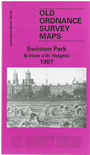
This detailed map covers an area of NW Salford, with coverage stretching from Partington Lane at Swinton eastward to Claremont Road at Irlams o'th'Height; and northward to the Swinton & Pendlebury UDC Offices. Features include Swinton Park Farm, Swinton House, Lawnswood, Pendlebury Children's Hospital, Fildes Fold Farm, St John's church, a stretch of the LNWR Clifton Branch with Clifton Tunnel, Victoria Park, tramways, Light Bourne Green, Swinton Mills, Moorland Works, Pendlebury Cottage, Crimble Lodge etc. On the reverse we include extracts from a street directory, incl Bingham Street, Manchester Road, Partington Lane, Worsley Road.
Note that the map cover accidentally refers to 'Irlam o'th'Heights' and not 'Irlams o'th'Height'. We will correct that when it goes to a reprint!
The map links up with Lancashire sheets 95.16 Pendlebury to the north, 103.03 Worsley to the west, 104.01 Pendleton North to the east and 103.08 Eccles to the south.