Old Ordnance Survey Maps of Pendlebury


We have published more than 2,100 maps in our series of Old Ordnance Survey Map reprints, including a large group in Lancashire. The maps are highly detailed. They are taken from the OS 1:2,500 (or 25 inch) maps and reduced to about 15 inches to the mile. Each covers an area of a mile and a half by a mile. They show streets with individual houses, tram tracks, railway tracks and even signals, factories, wharves and such details as fountains and water troughs. They will provide hours of fascination for historians and genealogists. The maps are neatly folded and each includes a specially written introduction to the area. Maps can be purchased on our On-line Mapshop where further information about titles is given. Or visit The Index Page for a full list to the series and details of Prices.


Here are the details of maps for Pendlebury:

  • Lancashire Sheet 95.16 Pendlebury 1907 - published 1997; intro by Chris Makepeace

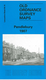
    This detailed map covers Pendlebury and part of Swinton, north of Salford. Bolton Road, with tramway, runs through the map and to the west of this are Newtown Mill, Bridgewater Mill, Moss Side Mill, Market Place, Royal Oak Print Works, and the area known as Newtown. Further south the LYR Pendleton & Hindley railway includes Swinton and Pendlebury stations and south of this is part of Swinton, incl Acme Mill, Albion Mill, Albion Foundry, Hope Mill, Cyclone Works, St Peter's church, Swinton Schools (at foot of map), Albert Mill. The eastern half of the map, east of Bolton Road, includes Newtown Colliery with tramway, the disused Botany Bay collieries (at top of map), Pepper Hill, Pendlebury Colliery with tramway, Clifton Hall Colliery, Clifton Junction station and stretches of the LNWR and LYR railways. We include street directory entries on the reverse, incl Moss Lane, Pendlebury Road, Stafford Road, Station Road.

    The map links up with Lancashire Sheets 95.12 Clifton to the north, 95.15 Wardley to the west, 96.13 Rainsough to the east and 103.04 Swinton Park to the south.


    Follow this link for a complete list of our Salford maps.

    You can order maps direct from our On-line Mapshop. For other information and prices, and other areas, go to The Index Page.


    Maps in the Godfrey Edition are taken from the 25 inch to the mile map and reduced to about 15 inches to the mile. For a full list of maps for the North West, return to the North West page.

    The Godfrey Edition / godfreyedition@btinternet.com / 12 August 2008