
 Here are the details of maps for Crumpsall (W):

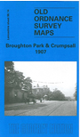
This detailed map covers a busy area of north Manchester, centred on the Bury Old Road. To the west of this is Broughton Park, incl Broughton Old Hall, Kersal Towers, Kersal Rectory and many large detached houses off the Bury New Road. Further north is Sedgley Park, incl Sedgley House (RC Training College), Sedgley New Hall etc. To the east is Crumpsall House, Castle Hill, Bowker Bank Works, Crumpsall Green, Miltonville, Crumpsall station, Crumpsall Crescent, Wesleyan Cemetery, St Mary's church etc. Several tramways are shown. part of Cheetham Hill (as far south as Darlington Street) is at the foot of the map. On the reverse we include a selection of street directory entries, incl Broughton Park, Bury Old Road, Crescent Road, Crumpsall Lane, Pons Street and Singleton Road.
The map links up with Lancashire Sheets 96.10 Heaton Park to the north, 96.13 Rainsough to the west, 96.15 Blackley to the east and 104.02 Cheetham to the south.