Old Ordnance Survey Maps of Blackley


We have published more than 2,000 maps in our series of Old Ordnance Survey Map reprints, including a large group in Lancashire. The maps are highly detailed. They are taken from the OS 1:2,500 (or 25 inch) maps and reduced to about 15 inches to the mile. Each covers an area of a mile and a half by a mile. They show streets with individual houses, tram tracks, railway tracks and even signals, factories, wharves and such details as fountains and water troughs. They will provide hours of fascination for historians and genealogists. The maps are neatly folded and each includes a specially written introduction to the area. Maps can be purchased on our On-line Mapshop where further information about titles is given. Or visit The Index Page for a full list to the series and details of Prices.


Here are the details of maps for Blackley:

  • Lancashire Sheet 96.15 Blackley & Lower Crumpsall 1915 - published 2007; intro by Chris Makepeace

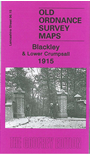
    This detailed map covers a busy area of north Manchester which includes Blackley, Lower Crumpsall, Barnes Green, the northern part of Harpurhey and the western part of Moston. The Rochdale Road runs north-south through the map. Coverage stretches from Crumpsall Park eastward to Herbert Street and Bute Street; and from Ringley Street (Harpurhey) northward to Oakworth Street (Blackley). The many features include at Charlestown: Booth Hall Infirmary, Boggart Hole Clough. At Blackley: St Peter's church, Market Street, Central Mills, Blackley Mill, Blackley Vale Mill. At Crumpsall: Crumpsall Vale Chemical Works, Delaunay's Road Institution, Crescent Road Institution, Jews Cemetery, Crumpsall Mills. At Harpurhey (the area with most streets, all with houses neatly shown): Christ Church, Scotch Finishing & Raising Works, public baths. On the reverse we include street directories for Charlestown Road, Delaunay's Road, Lion Street, Market Street, Old Road, Rochdale Road and Westbury Road.

    The map links up with Sheets 96.11 Higher Blackley to the north, 96.14 Broughton Park to the west, 96.16 Moston to the east and 104.03 Harpurhey to the south.


    Follow this link for a complete list of our Manchester maps.

    You can order maps direct from our On-line Mapshop. For other information and prices, and other areas, go to The Index Page.


    Maps in the Godfrey Edition are taken from the 25 inch to the mile map and reduced to about 15 inches to the mile. For a full list of maps for the North West, return to the North West page.

    The Godfrey Edition / godfreyedition@btinternet.com / 14 August 2008