
 Here are the details of maps for Heaton Park:

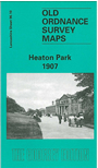
The central feature of this detailed map is Heaton Park, incl Heaton House and Heaton Farm. To the west is the Rooden Lane area, incl Heaton Park station, the tramway along Bury Old Road, Albion Mill, St Hilda's church, High Bank, Parkside Mill, St Margaret's church, and several terraced streets. On the right side of the map is Middleton Road with tramway incl a spur to Heaton Park, Middleton Road Dye Works, Heaton Mills, Heaton Vale Dye Works, Boggart Hole Farm. On the reverse we include street directory extracts, incl Bury Old Road, Egerton Street, Heaton Park Road, Newtown Street, Ogden Street, Ostrich Lane, Park Street, Whittaker Lane.
The map links up with Sheets 96.09 Prestwich to the west, 96.11 Higher Blackley to the east and 96.14 Broughton Park to the south.