
Old Ordnance Survey Maps of Devon
We have a range of detailed maps for Devon towns and we also cover the whole county at the Inch to the Mile scale.
All maps are available from our On-line Mapshop.
Devon County Council was formed in 1889. There was a reorganisation in 1974, with a county council and ten Districts; City of Exeter,
City of Plymouth, East Devon, Mid Devon, North Devon, South Hams, Teignbridge, Torbay, Torridge, and West Devon. However, in 1998
Plymouth and Torbay both became unitary authorities.
See This Page for a summary of the county's local government history.
The following maps are taken from the OS 25" maps and reduced to a scale of approximately 15 inches to the mile.
They are extremely detailed, showing individual houses, details such as railway tracks, pathways,
pubs, factories and even minutiae such as fountains and signal posts. Each map includes an introduction.
 These are the maps we publish for Devon:
019.06 Bideford 1904 - published 2011; intro by Richard Oliver
045.07 Tiverton 1903 - published 2005; intro by Richard Oliver
070.04 Honiton 1903 - published 2011; intro by Richard Oliver
070.13 Ottery St Mary 1903 - published 2026; intro by Richard Oliver
072.05 Axminster 1903 - published 2011; intro by Richard Oliver
080.05 Exeter (West) & Exwick 1904 - published 2026; intro by Richard Oliver
080.06a Exeter 1888 - published 2011; intro by Richard Oliver  080.06b Exeter 1904 - published 1995; intro by Alan Godfrey
080.07 Exeter (East): Heavitree & Whipton 1904 - published 2026; intro by Richard Oliver
080.10 Exeter (South) 1904 - published 2026; intro by Richard Oliver
084.07 Lyme Regis 1903 - published 1997; intro by Alan Godfrey primarily a Dorset town
092.03 Exminster 1904 - published 2026; intro by Richard Oliver
092.04 Topsham 1904 - published 2026; intro by Richard Oliver
093.16 Budleigh Salterton 1933 - published 2026; intro by Richard Oliver
102.16 Dawlish 1904 - published 2026; intro by Richard Oliver
103.01 Exmouth 1933 - published 2026; intro by Richard Oliver
105.08 Tavistock 1905 - published 2003; intro by Tom Greeves
109.12 Newton Abbot (North) 1904 - published 2017; intro by Richard Oliver
109.16 Newton Abbot (South) 1904 - published 2017; intro by Richard Oliver
110.07 Teignmouth & Shaldon 1904 - published 2026; intro by Richard Oliver
116.14 Torquay 1904 - published 2011; intro by Richard Oliver
121.05 Totnes 1904 - published 2014; intro by Tom Greeves
122.05 Paignton 1904 - published 2003; intro by Richard Oliver
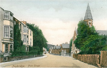
125.02 Ivybridge 1905 - published 2005; intro by Tom Greeves
128.02 Brixham 1904 - published 2016; intro by Richard Oliver
080.06b Exeter 1904 - published 1995; intro by Alan Godfrey
080.07 Exeter (East): Heavitree & Whipton 1904 - published 2026; intro by Richard Oliver
080.10 Exeter (South) 1904 - published 2026; intro by Richard Oliver
084.07 Lyme Regis 1903 - published 1997; intro by Alan Godfrey primarily a Dorset town
092.03 Exminster 1904 - published 2026; intro by Richard Oliver
092.04 Topsham 1904 - published 2026; intro by Richard Oliver
093.16 Budleigh Salterton 1933 - published 2026; intro by Richard Oliver
102.16 Dawlish 1904 - published 2026; intro by Richard Oliver
103.01 Exmouth 1933 - published 2026; intro by Richard Oliver
105.08 Tavistock 1905 - published 2003; intro by Tom Greeves
109.12 Newton Abbot (North) 1904 - published 2017; intro by Richard Oliver
109.16 Newton Abbot (South) 1904 - published 2017; intro by Richard Oliver
110.07 Teignmouth & Shaldon 1904 - published 2026; intro by Richard Oliver
116.14 Torquay 1904 - published 2011; intro by Richard Oliver
121.05 Totnes 1904 - published 2014; intro by Tom Greeves
122.05 Paignton 1904 - published 2003; intro by Richard Oliver
125.02 Ivybridge 1905 - published 2005; intro by Tom Greeves
128.02 Brixham 1904 - published 2016; intro by Richard Oliver
See separate page for Plymouth and Devonport maps.
Devon is also covered in our Inch to the Mile series. These are the principal sheets for the county:
275/292 Bideford Bay & Lundy Island 1896 - published 2011; intro by Richard Oliver. Includes a map of Appledore.
277/278 Ilfracombe & Minehead 1897 published 2010; intro by Mike Bone. Includes a map of Ilfracombe
293 Barnstaple, South Molton & Exmoor (West) 1897 - published 2011; intro by Richard Oliver. Includes a map of South Molton.
294 Dulverton & The Brendon Hills 1896 - published 2011; intro by Richard Oliver. Includes a map of Dulverton.
307/308 The Hartland Peninsula 1894 published 2009; intro by Richard Oliver. Includes a map of Stratton
309 North Devon (Taw & Torridge Valleys) 1907 - published 2002; intro by Richard Oliver. Includes a map of Chulmleigh.
310 Upper Exe Valley 1907 - published 2002; intro by Richard Oliver. Includes a map of Bampton.
311 Chard, Wellington & the Blackdown Hills 1896 - published 2008; intro by Richard Oliver. Includes a map of Culmstock
323 Holsworthy & the Upper Tamar 1894 published 2009; intro by Richard Oliver. Includes a map of Holsworthy
324 North Dartmoor & Mid-Devon 1887 - published 2005; intro by Tom Greeves. Includes a map of South Zeal.
325 Exeter & the Lower Exe Valley 1888 - published 2004; intro by Richard Oliver. Includes a map of Whimple.
326/340 Ottery St Mary & the East Devon Coast 1896 - published 2008; intro by Richard Oliver. Includes a map of Ottery St Mary
337 Middle Tamar & Caradon 1894 - published 2001; intro by Richard Oliver. Includes a map of Calstock.
338 Dartmoor 1908 - published 2003; intro by Tom Greeves. Includes a map of Princetown.
339 Chudleigh, Exmouth & Newton Abbot 1884-88 - published 2008; intro by Richard Oliver. Includes a map of Chudleigh.
348 Plymouth to Polperro 1894 - published 2005; intro by Tom Greeves. Includes a map of Polperro
349 South Dartmoor & the South Hams 1909 - published 2005; intro by Tom Greeves. Includes a map of South Brent.
350/356 Torbay 1896 - published 2008; intro by Richard Oliver. Includes a map of Stoke Fleming.
354/355 Eddystone, Salcombe & Bigbury Bay 1908 - published 2006; intro by Richard Oliver. Double-sided map.
For full details of this series go to the One Inch page.
 Most maps in the Godfrey Edition are taken from the 25 inch to the mile map and reduced to about 15 inches to the mile.
For Plymouth go to the Plymouth page.
For a full list of English maps, return to the England page
Most maps in the Godfrey Edition are taken from the 25 inch to the mile map and reduced to about 15 inches to the mile.
For Plymouth go to the Plymouth page.
For a full list of English maps, return to the England page
This list shows all our maps for the area. We try to keep a full range in print but inevitably some titles fall out of print from time to time.
These are noted in our On-line Mapshop.
Alan Godfrey Maps, Prospect Business Park, Leadgate, Consett, DH8 7PW. Tel 01207 583388
The Godfrey Edition / sales@alangodfreymaps.co.uk / 3 July 2026
 These are the maps we publish for Devon: