
 Here is information about Sheet 324:
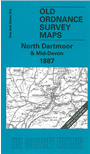
This Inch to the Mile map covers a central area of Devon, encompassing northern Dartmoor and the area around Okehampton. Coverage stretches from Northlew eastward to Colebrooke and Cheriton Cross, and from Hatherleigh southward to Chagford and (at the extreme foot of the map) Moreton Hampstead. Features on the map include Cawsand Hill, Prestonbury Castle; and railways include the LSWR line through Okehampton, the Holsworthy Branch, and the line climbing 1,800 feet to the peat works on Rattlebrook and Amicombe Hill. On the reverse we include a detailed map of the village of South Zeal, with directory.
It is not possible to list the many hamlets, farmsteads and other topographical features shown on these maps. However, you may find it useful if we list the towns and principal villages or church parishes that are included on this map. Links are given for those for which detailed large-scale maps are also available.
Index maps are available showing the areas covered by the Inch to the Mile maps. Go to This page
You can order maps direct from our On-line Mapshop. For a full list of Inch to the Mile maps go to the Inch to the Mile page, where you will also find details of prices. For information on the rest of the series, go to The Index Page.