
 Here is information about Sheet 310:
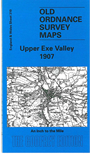
This Inch to the Mile map covers an area of NE Devon centred on Tiverton. Coverage stretches from Thelbridge eastward to Uffculme, and from Shillingford and Clayhanger southward to Cullompton. The GWR Exe Valley Branch runs through the map, and there is also the Tiverton Branch. On the reverse we include an extract from Devon Sheet 24.15 and this shows the small town of Bampton in detail, including station, quarries, site of Castle, and includes a directory.
It is not possible to list the many hamlets, farmsteads and other topographical features shown on these maps. However, you may find it useful if we list the towns and principal villages or church parishes that are included on this map. Links are given for those for which detailed large-scale maps are also available.
Index maps are available showing the areas covered by the Inch to the Mile maps. Go to This page
You can order maps direct from our On-line Mapshop. For a full list of Inch to the Mile maps go to the Inch to the Mile page, where you will also find details of prices. For information on the rest of the series, go to The Index Page.