
 Here are the details of maps for Streatham (W) & Tooting:

We have published two versions of this map, showing how the area changed across the yearw. The maps cover the eastern part of Tooting Graveney, and west Streatham, an area stretching from Foulser Road eastward to Pendennis Road and Polworth Road, and from Tooting Bec Common southward to Barrow Road.
Features include Tooting College, Newlands House asylum, Furzedown Park, Tooting Graveney Common, Manor Park, Streatham High Road, Streatham Green, St Leonard's church, St Alban's church, Streatham Park, Streatham station. Each map includes a selection of street directory entries.
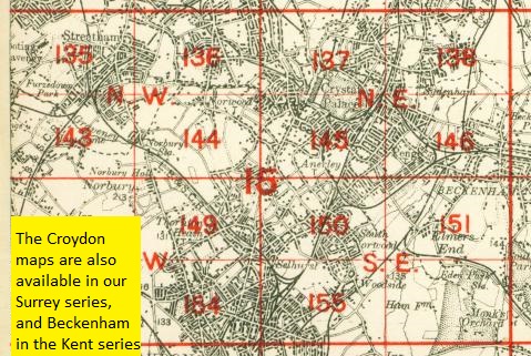
The map links up with London Sheets 125 Clapham Park to the north, 134 Tooting to the west, 136 Lower Norwood to the east, and 143 Lower Streatham to the south.
 Follow this link for a complete list of our London maps .