Old Ordnance Survey Maps of Lower Streatham


We have published more than 1,800 maps in our series of Old Ordnance Survey Map reprints, some 300 of them in the London area. The maps are highly detailed. They are taken from the OS 1:2,500 (or 25 inch) maps and reduced to about 15 inches to the mile. They show streets with individual houses, tram tracks, railway tracks and even signals, factories, wharves and such details as fountains and water troughs. They will provide hours of fascination for historians and genealogists. The maps are neatly folded and each includes a specially written introduction to the area. Maps can be purchased on our On-line Mapshop where further information about titles is given. For other information and Prices, see Index Page.


Here are the details of maps for Lower Streatham:

  • London Sheet 143 Lower Streatham 1894 - published 1993; introduction by John W Brown

    We have published just the one map for this area. It covers an area stretching from Gorringe Park eastward to Streatham High Road, and from Besley Street and Greyhound Lane southward to Grove Road and Lonesome. Lower Streatham is in the top right corner, where a feature is an India Rubber factory; the rest of the map is still largely undeveloped, and includes Lonesome, a hamlet within Mitcham parish that was still so remote that it includes a chemical works and fireworks factory. To the west is Gorringe Park and a few streets being built around Graham Road. On the reverse we extend coverage south by including part of Surrey Sheet 14.01 and this includes Commonside East, Woodite Works, and a windmill on Mitcham Common.

    An index map showing the areas covered by this and adjacent maps is available here. 
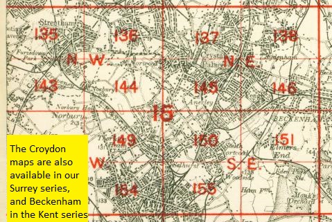
The map links up with London Sheets 135 West Streatham to the north, 142 Merton to the west, 144 Norbury to the east.


    Follow this link for a complete list of our London maps .

    You can order maps direct from our On-line Mapshop. For other information and Prices, see Index Page.


    Maps in the Godfrey Edition are taken from the 25 inch to the mile map and reduced to about 15 inches to the mile. For a full list of maps for London, return to the London page

    The Godfrey Edition / godfreyedition@btinternet.com / 17 August 2005