
 Here are the details of maps for Great Malvern (East):

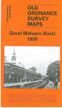
This detailed map covers the eastern part of Great Malvern, with coverage extending from the Priory Gardens eastward to Sherrard's Green, and from St James's Road southward to Court Road.
Features include railway with station, Priory Gardens, Council House, Hatley St George, Swan Pool, Davenham, Mowbray House and other large houses, Girls College, Christ Church, Baths, Tomatoland, Cemetery, Chase Estate, Pickersleigh, Pound Bank, Court Farm, Old Elm Gospel Hall, Sherrad's Green, Moat Court etc. On the reverse we include a selection of street directory entries, incl Avenue Road, Barnards Green, Chase - Lower and Upper Roads, Court Road
The map links up with sheets 39.12 Gt Malvern to the west and 40.05 Malvern Link to the north.