 Here are the details of maps for Malvern Link:

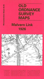
This detailed map covers most of Malvern Link, with coverage extending from Albert Park Road northward and eastward to St Leonard's church, Newland.
Features include railway with station, Upper Howsell, Quest Hills, St Cuthbert's school, saw mill, laundry, Link Farm, motor works, St Matthias church, Worcester Road area, St Leonards and convent, Beauchamp Almshouses, Newland, The Grange, St Leonard's church. On the reverse we include a selection of street directory entries, incl Church Road, Howsell Road, Pickersleigh Road, Richmond Road, Worcester Road.
The map links up with sheet 40.09 Gt Malvern East to the south.