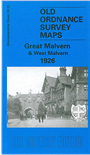
 Here are the details of maps for Great Malvern (West):

This detailed map covers the western part of Great Malvern, with coverage extending across North Hill and Sugarloaf Hill to West Malvern. Note that Herefordshire is left blank.
Features include Priory Church, Assembly Rooms, Malvern Hydro, Promenade Gardens, Rose Bank Gardens, Church Street, Belle Vue Terrace, Foley Arms Hotel, St Ann's Well, Baptist Church, Holly Mount, Holly Mount Wood, Malvern Hotel, Lyttelton School, Public Library, Green Valley, Lady Howard de Walden Drive, North Malvern Quarries, Holy Trinity church, Link Top, St James church West Malvern, The Dingle, Upper House Farm, St James's, St Edward's Orphanage, Open Air School, rifle range etc. On the reverse we include street directory entries for Abbey Road, Belle Vue Terrace, and Worcester Road.
The map links up with sheets 40.09 Gt Malvern East to the east and 39.16 Malvern: Wyche to the south.