Old Ordnance Survey Maps of West Sussex

  • These detailed maps normally cover an area of about one and a half miles by one mile. Each map includes an introduction.
  • They are available through our On-line Mapshop

  • Here are the details of the maps for New Shoreham:

  • Sussex Sheet 65.09 New Shoreham 1931 - published 2024; intro by Alan Godfrey. ISBN.978-1-78721-727-0

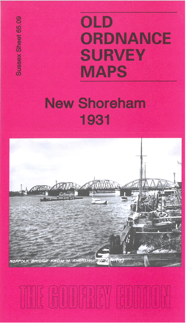
    This detailed map includes the centre of New Shoreham, or Shoreham-by-Sea, and the area westward towards Lancing.

    Features include St Mary's Church, Toll Bridge, Grammar School, railway with station (in top right corner), Bungalow Town Halt, Children's Homes, New Salts Farm, large area of Shoreham Beach including Bungalow Town area, Norfolk Bridge etc

    Extracts from a contemporary directory are included on the reverse together with a specially written introduction.

    The map links up with sheet 65.05 Old Shoreham to the north, 64.12 South Lancing to the west and 65.10 Kingston by Sea to the east.


  • Follow these links for complete lists of our West Sussex and East Sussex maps. For other information and prices, and other areas, go to The Index Page.
  • Most maps in the Godfrey Edition are taken from the 25 inch to the mile map and reduced to about 15 inches to the mile. For a full list of maps for England, return to the England page.
    The Godfrey Edition / sales@alangodfreymaps.co.uk / 22 March 2024