Old Ordnance Survey Maps of West Sussex

  • These detailed maps normally cover an area of about one and a half miles by one mile. Each map includes an introduction.
  • They are available through our On-line Mapshop

  • Here are the details of the maps for Lancing:

  • Sussex Sheet 64.12 South Lancing 1932 - published 2024; intro by Alan Godfrey. ISBN.978-1-78721-722-5

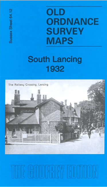
    This detailed map covers South Lancing, including Lower Cokeham.

    Features include railway with station, Southern Railway Carriage Works, Cokeham Manor, Lower Cokeham, nurseries, St Michael & All Angels church, Culver House, Monks Farm, Warrenhurst, Three Horseshoes Inn, Salt Lake, Old Salts Farm, Lancing Beach, etc.

    Extracts from a contemporary directory are included on the reverse together with a specially written introduction.

    The map links up with sheet 65.09 New Shoreham to the east.


  • Follow these links for complete lists of our West Sussex and East Sussex maps. For other information and prices, and other areas, go to The Index Page.
  • Most maps in the Godfrey Edition are taken from the 25 inch to the mile map and reduced to about 15 inches to the mile. For a full list of maps for England, return to the England page.
    The Godfrey Edition / sales@alangodfreymaps.co.uk / 22 March 2024