 Here are the details of the maps for Kingston Buci:

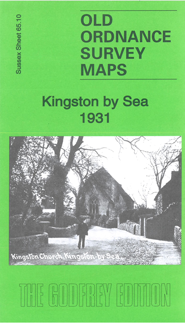
This detailed map gives coverage from the eastern part of Shoreham to west Southwick, including Kingston by Sea, sometimes known as Kingston Buci.
Features include Shoreham Harbour, Shoreham Beach, Old Fort, chemical works, The Ham, Dolphin Soap Works, Children's Homes, railway from Shoreham to Southwick stations, harbour entrance, Kingston Railway Wharf, Kingston House, St Julian's church, lighthouse and lights, part of Southwick Green, lock to canal, etc
Extracts from a contemporary directory are included on the reverse together with a specially written introduction.
The map links up with sheet 65.09 New Shoreham to the west and 65.11 Portslade by Sea to the east.