 Here are the details of the maps for Old Shoreham:

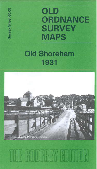
This detailed map gives good coverage of Old Shoreham and the northerrn part of New Shoreham, the two later combined as Shoreham-by-Sea, and also extends west to Lancing College.
Features include St Nicolas Church, Old Shoreham Bridge, Red Lion pub, River Adur, Swiss Gardens, West and East Lake, Little Buckingham, Shoreham Court, Horsham & Shoreham railway line, Bridge Works, Sussex Pad Hotel, St Mary & St Nicolas College (Lancing College), College Farm etc.
Extracts from a contemporary directory are included on the reverse together with a specially written introduction.
The map links up with sheet 65.09 New Shoreham to the south.